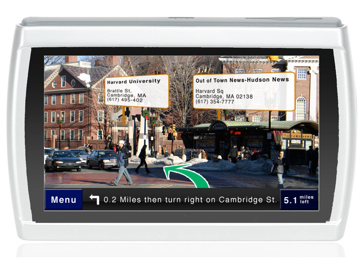
Imagine that instead of having a poorly rendered 3D map on your GPS you're able to see the world as it exists with your GPS data overlay on your reality.
I call this augmented reality. The concept is that you see the world as it actually exists via a camera in the back of the GPS device. The arrows for directions appear to be directly on the road surface the way it's done in most football games. In addition you can get point of interest information on buildings as you drive by.
Mac from petitinvention got me thinking about this concept with his own mobile internet device. While his concept is perhaps the longer term future I do think that GPS devices could deliver something along these lines in the next few years. Now that Google, Amazon, and Microsoft have driven fleets of cars around the country taking pictures of roads and landmarks with GPS information it's only a matter of time untill the technology catches up. The nice thing is that you don't even need high tech image-recognition for this to work. You just need precise triangulation of your GPS position and the road edges.
